WHERE EARTH MEETS SIGNAL.
Terrain-aware planning,
from feasibility to evidence.
Will the link close? Will the power last? FresnelPath answers both — before you mobilize. Analyze LoRaWAN, Wi-Fi HaLow, LEO satellite, and point-to-point links with ITU-R propagation, GLO-30 terrain, and PVGIS solar viability — then publish the evidence.
30–40%
of IoT deployments require unplanned re-siting
2–5
field revisits eliminated per gateway
Weeks → Hours
planning time with physics-based analysis
From site input to decision
A planning workflow that does not end at the chart.
Capture sites, radio context, equipment and constraints.
Run path, coverage, solar, satellite or comparison workflows.
Read outcomes, assumptions, risks and next actions.
Freeze artifacts and share the right scope with the right reader.
The FresnelPath platform
From path feasibility to published evidence.
Four capability areas, one traceable workflow — every calculation, terrain lookup, and assumption carries through to the report.
Path & Terrain
Point-to-point feasibility over real terrain — will the link close, and with how much margin?
- ▸ 6 ITU-R propagation models with automatic routing (FSPL, Okumura-Hata, COST-231, ITM, ITWOM 3.0, P.1812-6)
- ▸ 4-method knife-edge diffraction (P.526-15) and 60% Fresnel-zone clearance
- ▸ Asymmetric TalkOut / TalkBack link budget with fade margin and P.840-8 snow/ice
- ▸ GLO-30 30 m terrain in interactive MapLibre GL 3D
Area & Network
Plan coverage and dimension a whole network before a single pole goes in the ground.
- ▸ Multi-gateway coverage heatmaps with best-server dominance and viewshed
- ▸ ITU-R P.1546-6 regional planning sweeps around candidate sites
- ▸ LoRaWAN dimensioning: SF7–SF12 time-on-air, capacity, ADR, 12 regional plans
- ▸ Interference C/(I+N) with channel planning by graph-coloring
Remote-Site Readiness
Will the power last, and is there a better radio for this site? Answer both before you mobilize.
- ▸ PVGIS solar viability with battery state-of-charge, worst-case month, and cloudy-day autonomy
- ▸ LEO satellite planning: TLE/SGP4 pass prediction, link budget, and Doppler
- ▸ Wi-Fi HaLow (802.11ah) node links, coverage, and coexistence
- ▸ Technology comparison across LoRaWAN, LR-FHSS, HaLow, and satellite
Decision & Reporting
Carry the calculation into audience-specific evidence you can publish, share, and defend.
- ▸ Reports for four audiences — regulator, customer, engineer, field worker
- ▸ Report scopes narrow the same analysis; PDF export citing the ITU-R model used
- ▸ Publish, share by link, or embed — with frozen, provenance-tracked artifacts
- ▸ Project dashboard for saved projects, published-report history, and quotas
The Deployment Team
One tool. Three working conditions.
Plan → Install → Launch.
Most RF tools stop at the desk. FresnelPath follows your team into the field — under the sun at 3,200 m and in the dark at a remote site.
RF Engineers & Network Planners
Model every ridge before touching a wrench. Six ITU-R propagation models, Fresnel zone clearance overlays, knife-edge diffraction, and full link budgets — at a desk, with maximum information density.
- 6 Propagation Models + 4-Method Diffraction
- Fresnel Zone Clearance · dBm Precision
- LoRaWAN SF/ADR Dimensioning
Field Installation Technicians
High-contrast sunlight-readable display with 2px borders and bold typography. Geomorphon terrain turns the map into a deployment guide — spur = mount point, peak = gateway candidate, hollow = dead zone.
- High-Contrast Sunlight-Readable Display
- Azimuth & Tilt Optimization
- Field Report Exports
Remote Ops & After-Hours Review
True-black UI for OLED screens — no glare, preserves dark adaptation at remote sites. A binary go/no-go verdict and a printable deployment brief for site handover and stakeholder review.
- True-Black OLED Display Mode
- Remote System Telemetry
- Deployment Brief PDF
BUILT FOR HARD TERRAIN
Designed for These Scenarios.
Built for where signals are hardest — mountain terrain, rough ground, remote sites.
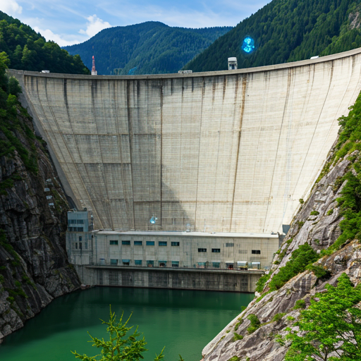
Hydropower & Dam Safety
Continuous LoRaWAN telemetry for structural integrity monitoring in deep canyon topographies with complex diffraction requirements.
Eliminate wasted site visits · Confirm coverage before ordering hardware
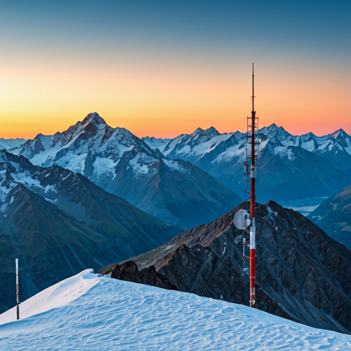
Alpine Hydrology Networks
High-reliability microwave backhaul for remote mountain weather stations above 4,000 m — factoring in extreme multipath fading and knife-edge diffraction.
Plan a 20-node network in an afternoon, not a week
Remote Energy Monitoring
Solar and micro-hydro generation sites beyond the grid — validate LoRaWAN coverage and solar viability for SCADA telemetry before mobilizing a field crew at elevation.
Model the link · Confirm the margin · Deploy with confidence
Decision & reporting
One analysis, the right evidence for each reader.
FresnelPath's strongest differentiator is carrying a calculation into persistent, audience-specific evidence. The same frozen result renders four ways.
Regulator
Model citations, band and EIRP basis, and coordination context — structured for regulatory review.
Customer
A plain decision — will it work, and what does it depend on — without the RF jargon.
Engineer
Full link budget, path profile, assumptions, and the propagation model actually used.
Field worker
Coordinates, antenna heights, and the install checklist — the essentials for the site visit.
Report scopes
At publish time, maps and charts are frozen as immutable, provenance-tracked artifacts — a shared link shows exactly what you saw, not a live recomputation.
Real ITU-R Reference Engines
Wraps the published Py1812 ITU reference code and itmlogic ITM v1.2.2 — not a re-implementation.
Copernicus GLO-30 Elevation
30 m resolution terrain data — same dataset used by the European Space Agency for global DEM products.
Tested to 4,000 m ASL
Developed and validated in Central Asian mountain terrain — including deployments above 4,000 m.
Common Questions
Questions from project teams
Do I need to be an RF engineer to use this?
No. Enter two coordinates, select a radio standard, and FresnelPath returns a go/no-go result with a link margin in plain numbers. Engineers on your team can go deeper into the propagation models when they need to.
How accurate is the terrain data?
FresnelPath uses the Copernicus GLO-30 dataset at 30 m spatial resolution — four times finer than the widely used SRTM, with approximately 4 m vertical accuracy globally. For mountainous terrain, this is among the highest-quality freely available global elevation sources.
What radios and regions does it support?
LoRaWAN across 12 regional frequency plans including EU868, US915, and RU864. For point-to-point backhaul, the tool supports link analysis at any frequency — microwave, UHF, or custom bands.
Can my team use it in the field without an internet connection?
Currently FresnelPath requires a connection to fetch terrain tiles and run propagation calculations. Offline field mode is on the roadmap — register your interest using the early-access form at the bottom of this page.
Do I need an account to use FresnelPath?
The core planning tool (path profile, link budget, LoRaWAN analysis, coverage heatmaps) is completely free with no account required. Some collaboration features — saving projects, sharing links, and export to PDF — require a free registration.
Can I export this for a regulator submission?
FresnelPath generates PDF path-profile reports and link budgets with the ITU-R model name, inputs, path-loss breakdown, and link margin. These provide technical evidence for a submission, but you must verify the current forms, limits, and authority requirements for your jurisdiction.
How do you handle atmospheric ducting and tropospheric refraction?
The ITU-R P.1812-6 model accounts for tropospheric refraction through the effective Earth radius factor (k = 4/3 standard) and includes time-variability statistics for the planned location. Gaseous absorption from O₂ and H₂O is computed per ITU-R P.676-12 for all path lengths.
What other LPWAN technologies do you support beyond LoRaWAN?
LoRaWAN has the deepest planning suite today — 12 regional plans, SF/ADR analysis, and full ToA capacity modeling. Wi-Fi HaLow and LEO satellite IoT are shipped planning workflows: HaLow link budgets with MCS and coverage analysis, and satellite pass prediction with link budgets from live orbital data. A technology-comparison view ranks LoRaWAN, LR-FHSS, Wi-Fi HaLow, and satellite LEO against the same path. Cellular NB-IoT / LTE-M planning is on the roadmap.
Is the source code open?
FresnelPath is open to use — the hosted version is free with no account required for core analysis. The propagation backend is licensed CC-NC (non-commercial). Commercial licensing is available on request for teams using it in paid engagements.
Commercial & team features
Building for private workspaces and commercial licensing
Core analysis is free with no account required. If your team needs private team workspaces, large-scale coverage runs, API access, or a commercial license for paid engagements, register your interest and I'll reach out when it's ready.
PRODUCT FEEDBACK & IDEAS
Talk to me about FresnelPath
Feature ideas, edge cases, bugs, missing regulatory data — I want to hear them. The goal is for you to be satisfied with the product itself.
Feature ideas & feedback
New analysis flows, UI improvements, missing model parameters
Regional compliance feedback
Tell us which authority, band limits, or submission evidence your deployment needs
Training for your team
RF fundamentals, LoRaWAN dimensioning, and ITU-R model interpretation
FresnelPath does not sell RF consulting or on-prem deployment services.